WHAT WE CAN DO FOR YOU
Inside Out Drones offers only the latest and greatest drones for your aerial photo and video needs. We are fully approved for commercial use by the FAA, we carry aviation insurance, general liability, commercial auto insurance, and pride ourself with a safe flying record.
All of the cameras shoot in high definition 1080P and 4K format. They are kept amazingly steady with the use of a steady shot gimbal. Ensuring your photos and video turn out perfect every time.
We use the latest in long range transponders to keep constant control over all of our drones at all times. We always keep our drones in line of sight of the operator, but we also have a first person view of the video in real time that will ensure we are capturing what you want. Our services include: aerial photography and videography, 3D mapping, building and construction inspection, agriculture inspection, damage assessment for insurance, aerial site survey, ground video production, professional editing, infrastructure inspection, drone sales and training, hazmat inspection, wildlife migration & preservation, and search and rescue.
We regularly service the midwest area of the United States however, we are available to travel wherever our services are needed.
Our drone tour services provide captivating and innovative ways to explore various locations using unmanned aerial vehicles (UAVs), commonly known as drones. Our services cater to different industries and purposes. Let’s explore some of those offerings:
Residential & Commercial Real Estate Media
FPV (First-Person-View) Drones: These drones revolutionize the client experience by providing dynamic and immersive tours of commercial properties. They capture stunning aerial footage, showcasing office spaces, warehouses, and other facilities.
Virtual Tours: Create engaging virtual tours for office spaces, hotels, and resorts. Highlight meeting rooms, ballrooms, amenities, and more.
Cinematic Footage: Utilize cinema-grade drone equipment to capture both interior and exterior shots of office buildings, enhancing marketing material.
FPV Drone Tours and Venue Promotion
FPV Drone Tours: Showcase hotel rooms, restaurants, wedding venues, and other spaces, inside and out.
HOTELS:
RESTAURANTS
BUSINESS PROMOTION
VENUE PROMOTION
FACTORY/WAREHOUSE
SCHOOL/UNIVERSITY
SPORTS TEAM PROMOTION
PARK PROMOTION
FACILITY PROMOTION
Lifestyle Productions: We can create captivating videos that highlight the overall experience for guests and visitors.
Live Aerial Broadcasts and Event Capturing
We provide live drone coverage for sports events and broadcasting.
Deliver scenic aerial imagery directly to broadcast feeds.
Videography for Various Sectors: From film/TV to public sector groups, drones capture aerial footage for marketing purposes.
These services enhance visual storytelling, engage audiences, and provide a fresh perspective on familiar places. Whether you’re a realtor, hotelier, filmmaker, or simply curious, drone tours offer a thrilling way to explore the world from above!
Insurance, Construction, and Maintenance Inspections
Drone inspections have revolutionized safety assessments and maintenance procedures across various industries
Drones Offer Enhanced Safety
Drones are Efficient and Fast
Internal Inspections
External Inspections
Roof Inspections
Cell Tower Inspections
Agriculture
AEC
Chemicals, Oil, and Gas: Monitor pipelines, tanks, and offshore platforms.
Electricity
Mining
Public Safety
Mapping and Photogrammetry
Drone inspections have revolutionized safety assessments and maintenance procedures across various industries. By utilizing unmanned aerial vehicles (UAVs), these inspections offer several benefits:
Enhanced Safety:
Drone inspections eliminate the need for human inspectors to physically access dangerous or hard-to-reach areas.
Inspectors can collect visual data without risking their safety by climbing scaffolding, ropes, or hazardous structures.
Efficiency and Speed:
Drones significantly reduce inspection time. They can swiftly cover large areas, capturing accurate and repeatable data.
Quicker deployment minimizes operational downtime, preventing revenue loss for companies.
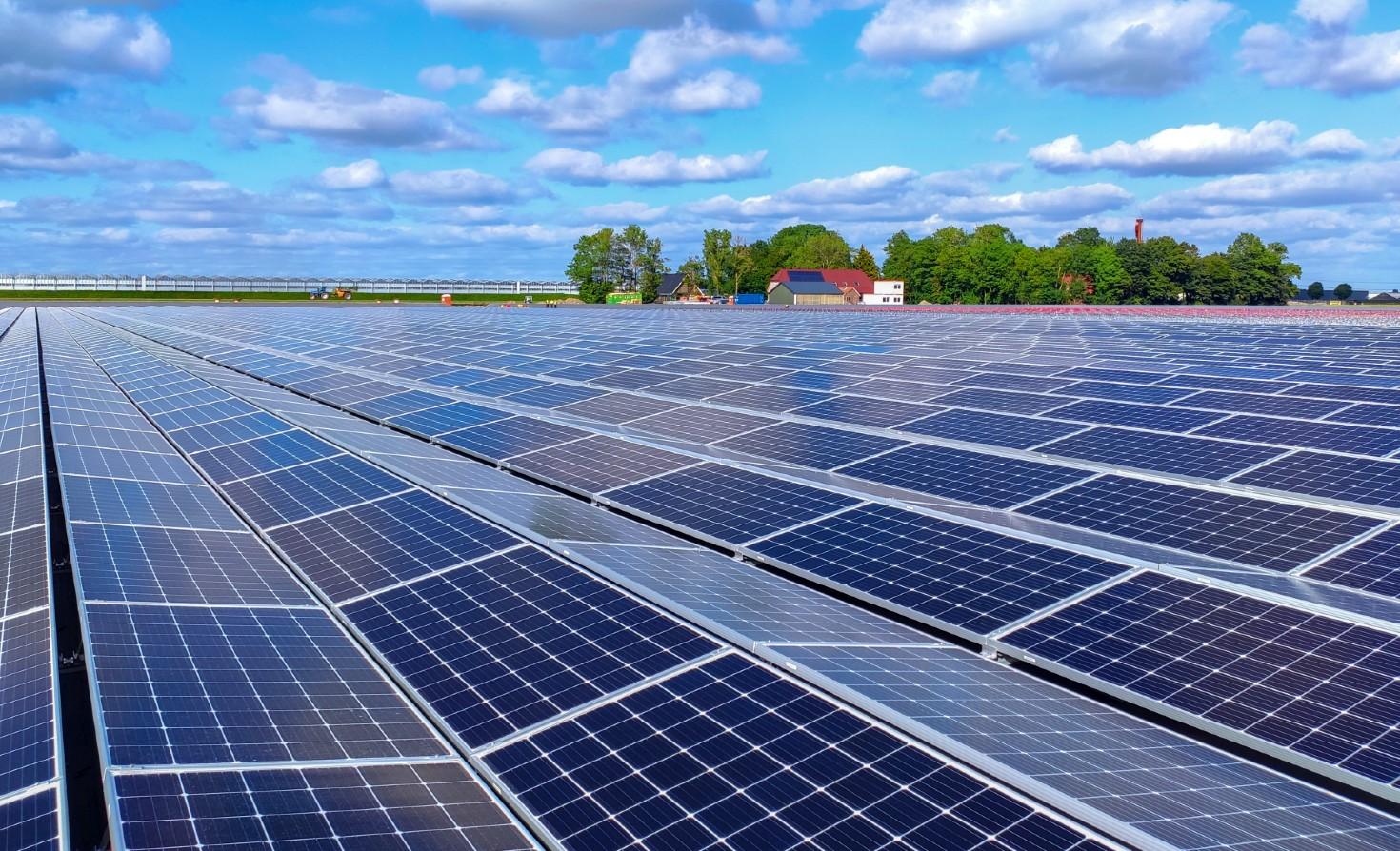
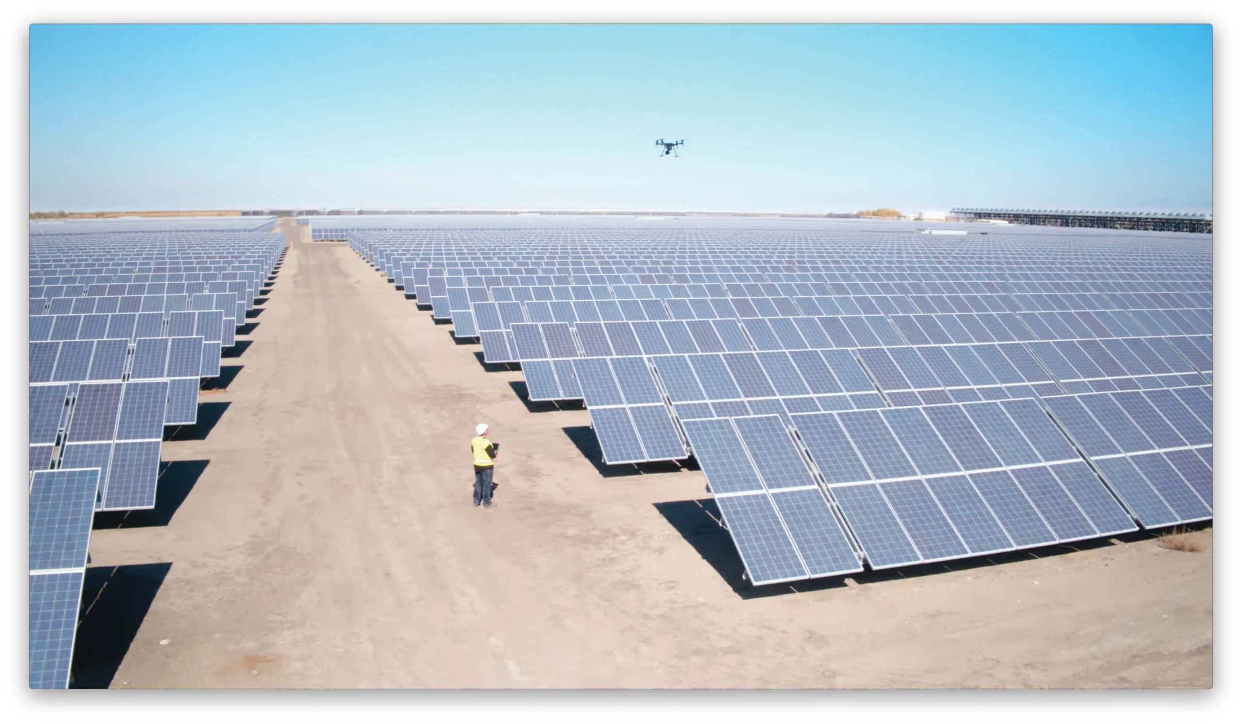
Solar Farm - Cell Tower Inspections
-
Cell Tower Inspections:
- Safety: Drones eliminate the need for human climbers, reducing the risk of accidents during inspections.
- Efficiency: Faster data collection and reduced inspection time.
- Cost-Effectiveness: Drones are more economical than traditional methods.
- Regular Monitoring: Routine inspections enhance tower reliability.
- Speed: Drones cover large areas quickly, capturing high-resolution images.
- Thermal Imaging: Drones equipped with thermal sensors detect faulty panels.
- Preventive Maintenance: Early identification of issues prevents costly damage.
- Operational Optimization: Drones improve efficiency and reduce costs.
Solar Farm Inspections:
Drones enhance safety, efficiency, and accuracy in both cell tower and solar farm inspections.
MAPPING & PHOTOGRAMMETRY
Drone photogrammetry is a fascinating technique that harnesses the power of drones to capture and analyze the world in a whole new way. Let’s dive into the details:
- What is Drone Photogrammetry?
- Drone photogrammetry is a subset of aerial mapping. It involves capturing a series of overlapping aerial images using drones and then using these images to create three-dimensional models.
- The process starts by taking overlapping photographs from multiple angles. These images are then stitched together using specialized software to create detailed 3D models or maps of objects, structures, or landscapes.
- The science behind drone photogrammetry relies on principles from trigonometry and computer vision. By analyzing the position and orientation of each image, the software determines the location and elevation of various points on the Earth’s surface.
- Photogrammetry vs. LiDAR:
- Photogrammetry and LiDAR are both powerful 3D mapping techniques, but they differ in their approaches:
- Photogrammetry:
- Relies on photographs taken from different angles to triangulate the position of points on an object’s surface and reconstruct its 3D geometry.
- Shines in capturing textures and colors, producing visually rich models.
- Best suited for tasks like capturing building facades, historical preservation, and environmental monitoring.
- LiDAR:
- Uses lasers to actively pulse light and measure its reflection, creating a 3D point cloud.
- Excels at capturing precise measurements and dense point clouds, making it ideal for highly accurate work.
- Useful for tasks like stockpile volumes, building dimensions, and mapping through vegetation.
- Photogrammetry:
- Photogrammetry and LiDAR are both powerful 3D mapping techniques, but they differ in their approaches:
- Applications of Drone Photogrammetry:
- Surveying: Companies can map vast areas by programming drones to take pictures automatically from specific locations.
- Remote Inspections: Assessing the condition of pipes (essential for the gas and oil industry) becomes easier using drone photogrammetry.
- Environmental Monitoring: Critical environments can be monitored by analyzing data from drone-captured images.
- Historical Preservation: Fragile artifacts and historical structures can be documented in three dimensions.
- Forestry and Land Management: Mapping forested areas and analyzing terrain.
- Construction and Infrastructure: Monitoring construction progress and assessing infrastructure.
- Emergency Response: Rapid assessment of disaster-affected areas.
Drone photogrammetry empowers us to explore, measure, and understand our world with unprecedented precision and detail.
SOLAR FARM & CELL TOWER INSPECTION
Cell Tower Inspections Using Drones:
Routine Inspections:
-
- Cell towers are critical infrastructure, and regular inspections are essential for their maintenance.
- Drones can replace human personnel by capturing high-resolution images of the tower from various angles.
- Benefits include safety, speed, and cost-effectiveness.
- Regular drone inspections enhance tower reliability.
Pre-Work Inspections:
- Before repair work, drones document damaged sections.
- Detailed data collected helps repair teams prepare better.
- Drone imagery guides repair efforts, improving efficiency.
Damage Assessment:
- After extreme weather events, drones quickly assess tower damage.
- Decisions on tower functionality and repair mobilization depend on this assessment.
- Ideal approach paths for repair teams are determined based on initial drone data.
Hazard Analysis:
- Drones monitor potential hazards during tower operation, maintenance, or repair.
- Even mundane issues like bird nests can be detected and addressed.
Benefits:
- Safer inspections without risking human lives.
- Faster data collection and reduced workload.
- Improved tower reliability and operational efficiency.
Solar Farm Inspections Using Drones:
Challenges of Traditional Inspections:
- Solar farms cover vast areas with thousands of panels.
- Manual inspection of each panel is inefficient and hazardous.
- Faulty panels must be tracked for maintenance.
Drones Enhance Efficiency:
- Drones equipped with thermal sensors (e.g., DJI Matrice 210 RTK V2 with XT2 payload) survey large areas.
- High-resolution RGB and thermal images are captured during a single flight.
- Inspection time is reduced by up to 70% compared to traditional methods.
Applications:
- Routine Inspections: Regular monitoring of solar panels.
- Preventive Maintenance: Identifying issues before they escalate.
- Damage Assessment: Assessing damage after extreme weather events.
- Efficiency Boost: Drones optimize operations and reduce costs.
Solar Energy Industry Growth:
- Solar power investments have increased globally due to climate concerns.
- Decreasing installation costs make solar energy more accessible.
- Drones play a critical role in optimizing solar farm operations.
Drones are transforming the inspection landscape, making cell tower and solar farm maintenance safer, faster, and more efficient.


